Students can go around the mountain and take in the spectacular views. Using the right set of questions, all these views become pieces of evidence, which include tilted sandstone, changing vegetation, water-eroded valleys, footpaths, and a cultural landscape developed over many years.
That is what makes the Grampians school excursions meaningful. Students get the chance to see geology, biodiversity, Aboriginal cultures, and environmental management within one landscape. The tour is not about separate trips to different sites, but can be used to formulate a story about the landscape’s formation and management.
Why Is Gariwerd a Strong Outdoor Classroom?
Gariwerd rises majestically above the flat plains of west Victoria. The lessons provided by this area of sandstone ridges, valleys, waterfalls, forests and cultural heritage sites include the fields of geography, science, history, sustainability and health & physical education.
Parks Victoria identifies Gariwerd as a rugged sandstone landscape containing significant biodiversity and the largest concentration of known Aboriginal rock art places in Victoria. The landscape gives students opportunities to investigate how physical, ecological and cultural systems relate to one another.
A central inquiry question can connect the entire program:
- How did sandstone shape Gariwerd?
- Why does vegetation change between valleys and ridges?
- How are cultural and environmental values protected together?
- What responsibilities do visitors have when entering Country?
- How should access be managed in a protected landscape?
One carefully explored question usually creates stronger learning than several activities with no shared purpose.
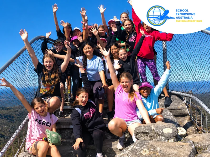
What Do Students Learn on Grampians School Excursions?
The location suits observation exercises for primary classes and more complex field studies for secondary classes. The journey and question-and-answer technique used must be appropriate for the students’ grade, physical ability, and school curriculum at the time.
How Did Sandstone Shape Gariwerd?
The ridges and valleys found on Gariwerd were created through geological actions occurring over millions of years. Deposits of sandstone have been formed, uplifted, and folded to become the ranges through weathering and erosion.
According to Agriculture Victoria, the terrain is characterised by inclined sandstone beds with steep scarps. These resistant rock layers form a series of ranges running broadly from north to south.
Students can look for evidence including:
- Tilted sandstone layers
- Cracks and weathered rock surfaces
- Differences between steep and gradual slopes
- Loose material below cliffs
- Stream channels and waterfalls
- Valleys formed between resistant ridges
It should not be about committing a geological timeline to memory when standing on a lookout point. Students should utilise their observations in coming up with an evidence-based interpretation of the landscape.
Geological Field Evidence That Students May Record
Physical interpretation of Gariwerd is significant; however, it is not the only interpretation possible. Gariwerd is an active Aboriginal cultural landscape associated with the Djab Wurrung, Jardwadjali, and Gunditjmara peoples.
Ask each student to finish with one sentence:
The evidence suggests this landform developed because…
This prompt moves the activity beyond drawing. It requires students to connect direct observation with ideas such as uplift, weathering and erosion.
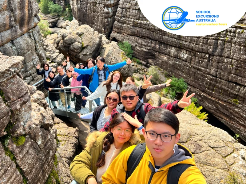
Why Must Cultural Learning Begin With Country?
A physical explanation of Gariwerd is important, but it is not the only way to interpret the landscape. Gariwerd is a living Aboriginal cultural landscape connected with Djab Wurrung, Jardwadjali and Gunditjmara peoples.
Appropriate Grampians Indigenous cultural school tours may help students learn about:
- Continuing relationships between people and Country
- The cultural importance of landforms and waterways
- Ways knowledge is maintained and shared
- Responsibilities involved in caring for Country
- The significance of cultural places
- The protection of rock art and heritage
Cultural learning should be led by Traditional Owners, Aboriginal educators or programs created with proper cultural authority. Teachers should confirm who developed the content, who delivers it and which information students may record.
How Should Students Behave at Rock Art Places?
Aboriginal Victoria explains that Gariwerd’s rock shelters include paintings, prints, tracks, bars and hand stencils created on protected rock surfaces.
Before arriving, students should know why they must:
- Remain on designated paths
- Avoid touching rock surfaces
- Follow photography instructions
- Listen carefully to the educator
- Avoid copying cultural imagery without permission
- Treat the site as a cultural place rather than an attraction
Proper behaviour is one of the objectives of the lesson. Apart from acquiring knowledge about the Country, they are also taught how to behave in such an important cultural setting.
What Environmental Changes Can Students Identify During the Walk?
During their walk within the Gariwerd, students can identify environmental changes in the short distances covered. A valley, an open forest, and a ridge may each have unique vegetation cover.
Students can compare:
- Plant height and density
- Canopy and understorey structure
- Wind and sun exposure
- Soil depth and surface material
- Moisture and shade
- Evidence of fire or regrowth
- Signs of animals and people
It is not about making the longest list of species. There will be connections between environmental factors and organisms that students need to explore.
The plants on the ridge might be shorter or more dispersed than the vegetation of the sheltered valley. The students will be able to explain the effects of the wind, shallow soils, exposure, and water availability on plants.
There is the official Gariwerd excursion guide of Parks Victoria which relates the geology of the area to its flora and fauna.
How Can Students Compare Two Habitats?
Select two safe observation points along the route. At each location, students record the same information:
- Dominant vegetation
- Ground surface
- Exposure to wind and sunlight
- Evidence of water
- Signs of animals or visitors
Back at school, students can compare their results and explain which environmental factors may have produced the differences.
This type of task works well within Grampians outdoor education because students experience the change while moving through the landscape.
How Are Cultural and Environmental Values Protected?
In addition to being a cultural landscape, Gariwerd is also a national park. Walking trails, barriers, viewing platforms, signs, and temporary closures are just some of the many access controls available.
Students should select one visitation site and consider:
- Why a track follows its current route
- What might happen without a designated path
- Which areas are protected by barriers
- How effectively signs communicate cultural values
- Where erosion or vegetation damage is visible
- How visitor behaviour could affect the site
Where a viewing platform gathers crowds in one location, it also stops uncontrolled movements through the vegetation. Likewise, a closure may be a burden for the visitors while offering protection to the fire-hit, destroyed or culturally important site.
Conditions may alter after fires, storms and even maintenance works. Teachers who plan school trips to the Grampians, Victoria are advised to check up-to-date Parks Victoria guidelines close to the date of the trip instead of using an itinerary written several months ago.
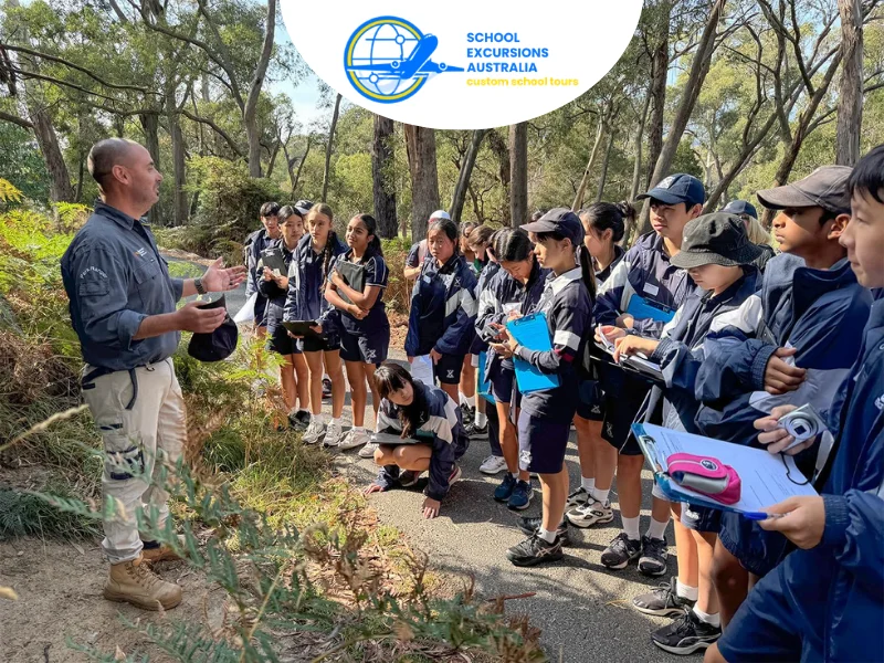
How Can Teachers Build the Day as a Learning Sequence?
The itinerary does not need a long list of attractions. It needs a sequence in which every experience adds evidence to the inquiry question.
What Would Students Be Able to Explore in the Morning?
The perfect way to begin would be through a lookout or geological structure that would be easy to find. It is at this point that the investigation question should be introduced along with the annotated field sketch.
How Can Cultural Learning Shape the Midday Program?
Continue with an appropriately guided cultural experience. Students can reconsider the landscape as Country rather than treating it only as a geological formation or recreation area.
A useful reflection question is:
What does cultural knowledge add that a geological description cannot explain?
The purpose is not to combine different knowledge systems into one simplified account. Students should recognise that each provides a distinct way of knowing and relating to place.
What Must Schools Confirm Before Departure?
Routes across Gariwerd vary significantly in distance, gradient, surface and exposure. A track suitable for one group may be inappropriate for another.
Confirm:
- Walking distance and estimated time
- Steep sections, steps or rock scrambling
- Toilets, shelter and rest points
- Accessible routes or alternative activities
- Supervision and emergency arrangements
- Mobile coverage and communication methods
- Current track closures and fire conditions
- Cultural protocols for planned sites
- Required clothing, footwear and water
The students should get factual information at an early stage. Shoes, sunscreen, fluids, appropriate clothing, and medication can be needed, according to the journey and time of year.
An alternative site and activity must also be chosen. The alternative must reflect the same curriculum objective and not become unstructured time.
What Should Students Be Able to Explain Afterwards?
An effective program is one that allows the students to tell you much more than just where they have been. Depending on the research conducted, the students will be able to tell you the following:
- How sandstone influences the shape of Gariwerd
- Why habitats vary across the ranges
- Why Gariwerd is culturally significant
- How visitors should behave at cultural places
- Why tracks, barriers and closures are used
- How field evidence supports an explanation
These outcomes provide a clearer measure of educational value than the number of locations included in the itinerary.
Conclusion
There is no requirement for Gariwerd to be analyzed in terms of geological, cultural, and recreational spots; nature serves as the connection. The students begin with the rock that is beneath their feet, followed by the concept of Country and access to the environment.
The teacher should check out the destination page for the Grampians and begin with one line of inquiry that relates to current classroom learning, and build from there.
FAQs
Yes, provided each component receives enough time and cultural content is delivered appropriately. The relationship between them should be explored without presenting distinct knowledge systems as interchangeable.
No. Accessible lookouts and shorter trails can support valuable observations. The route should be selected according to educational purpose, safety, accessibility and student capability.
Suitable outputs include an annotated landscape diagram, habitat comparison, fieldwork report or evaluation of a visitor-management strategy. The final task should require evidence collected during the excursion.
Yes. Weather, fire conditions, maintenance and track damage may affect access. A backup plan should be prepared before departure and linked to the same learning goals.
An easy walk may facilitate habitat comparison and visitor management. Students can work independently or in groups, but the recording activity must be kept short so that they have time to observe the surroundings instead of staring at the worksheet.
